Hakuba Maps
Ski Piste Guides, Trail Maps and Hakuba Village maps
On this page visitors can access, download and print all the Hakuba maps needed – ski piste guides, trail maps, restaurant guides and village maps. Hakuba Village and ski piste maps are available in both English and/or Japanese at the base areas, ticket offices and most good Hakuba accommodation providers.
Hakuba Maps | Hakuba Guides
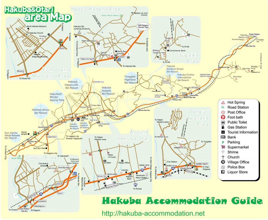
Hakuba Accommodation Map
Check the location of different accommodation options. Enter your dates and guest numbers to check the most up to date prices and availability.
Hakuba Google Maps
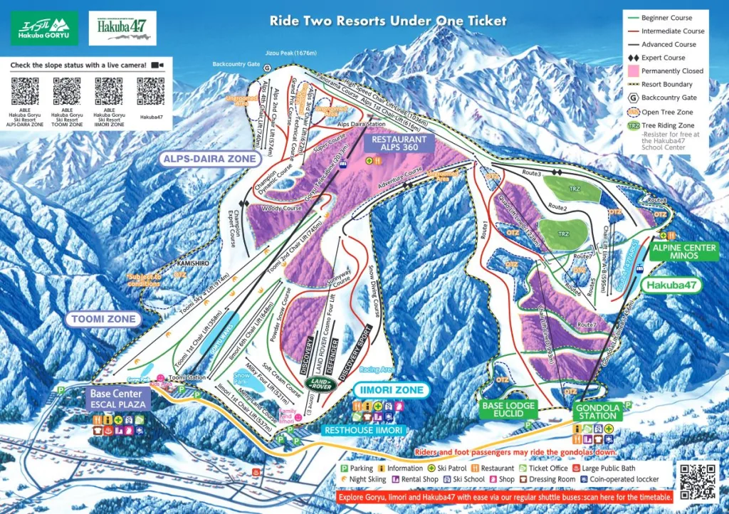
Hakuba 47 & Goryu
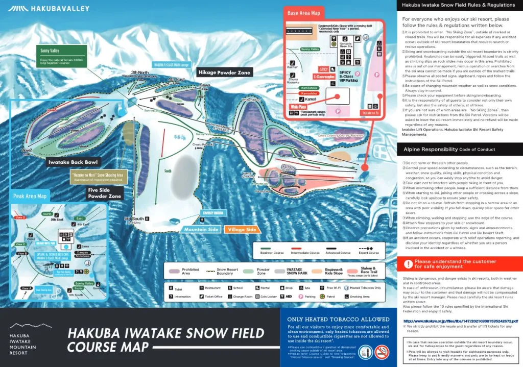
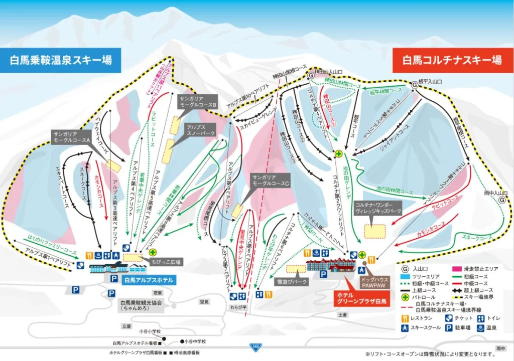
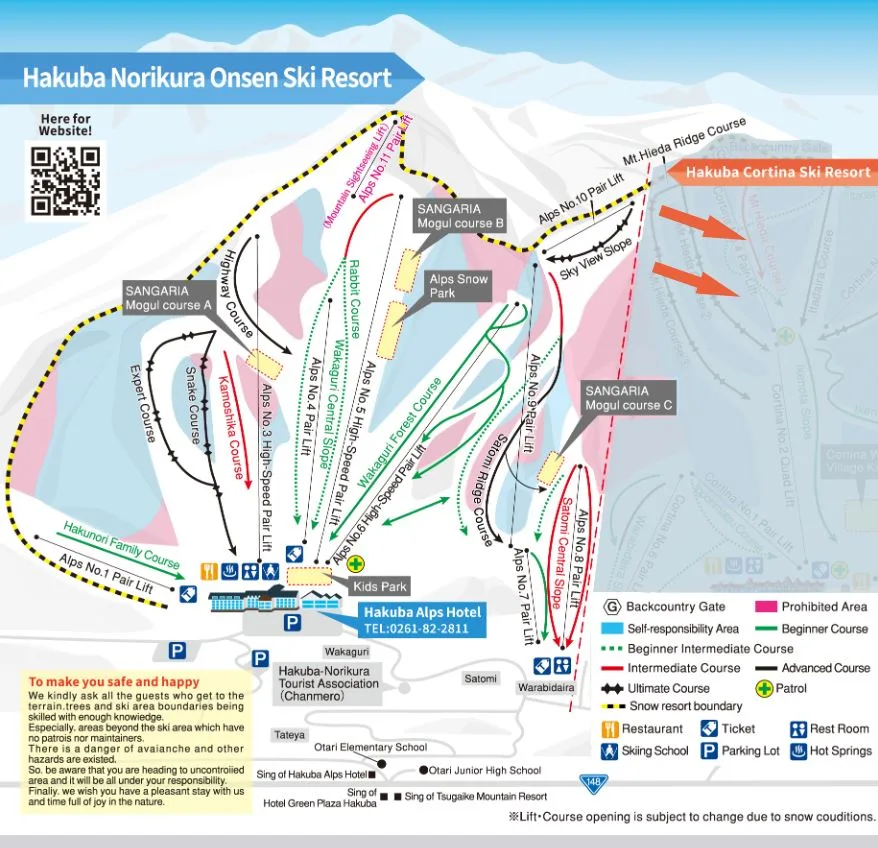
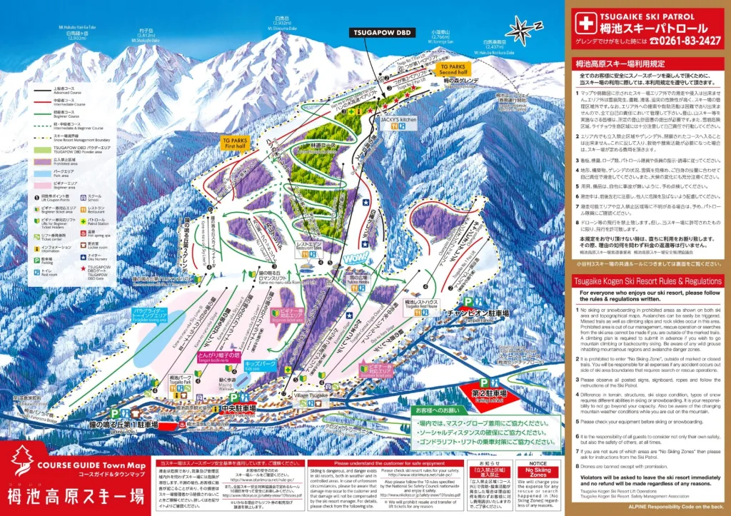
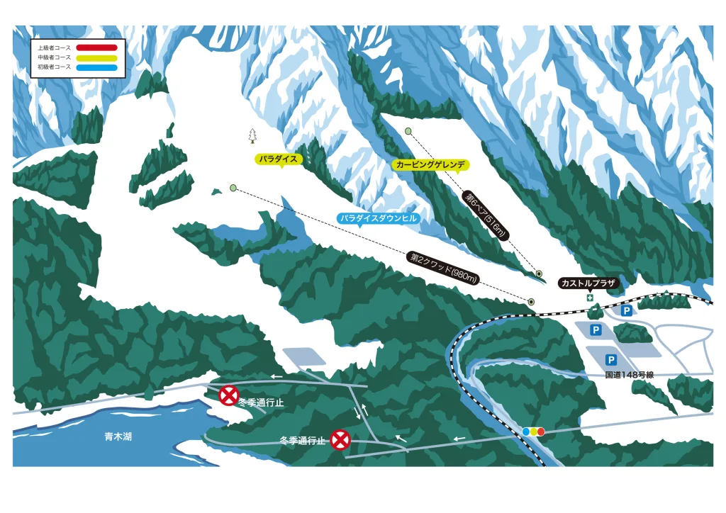
Tsugaike Kogen, Norikura, Cortina & Iwatake
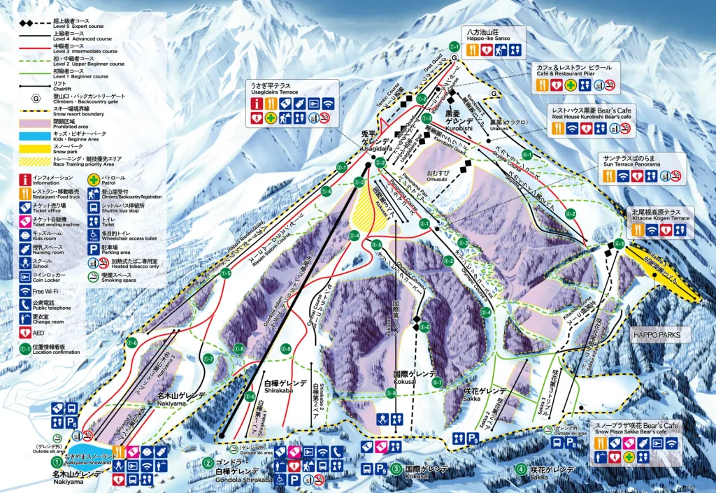
Hakuba Happo-one Map
Hakuba Maps - Hakuba Valley
The most comprehensive guide to all services right across the valley, including restaurants, accommodation, onsen, and much more!
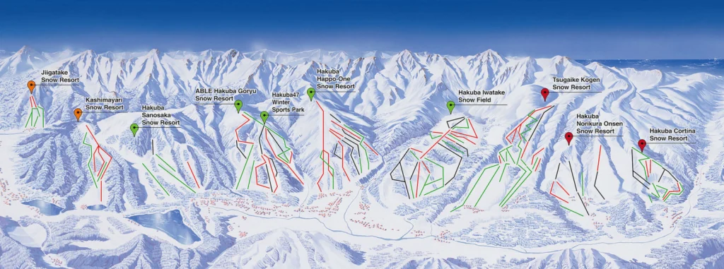
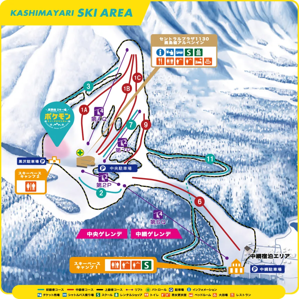
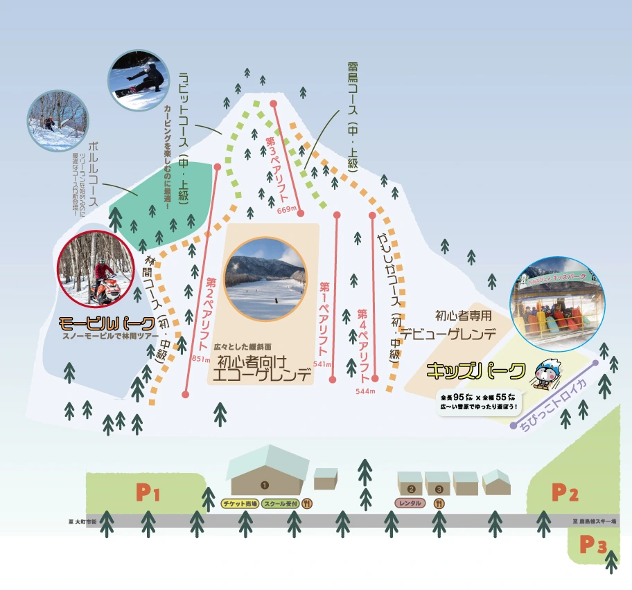
Hakuba Ski Trail Maps
Find out more about all of the various Hakuba ski resorts via our Hakuba Ski Resort Guide
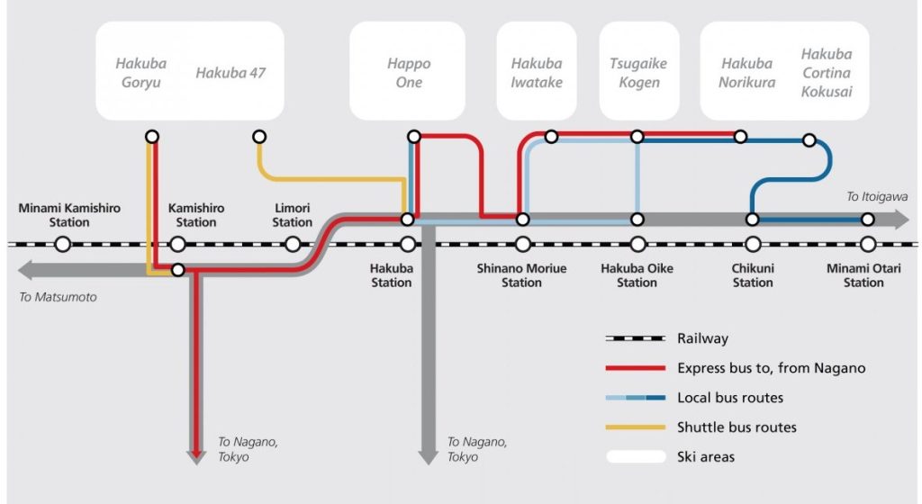
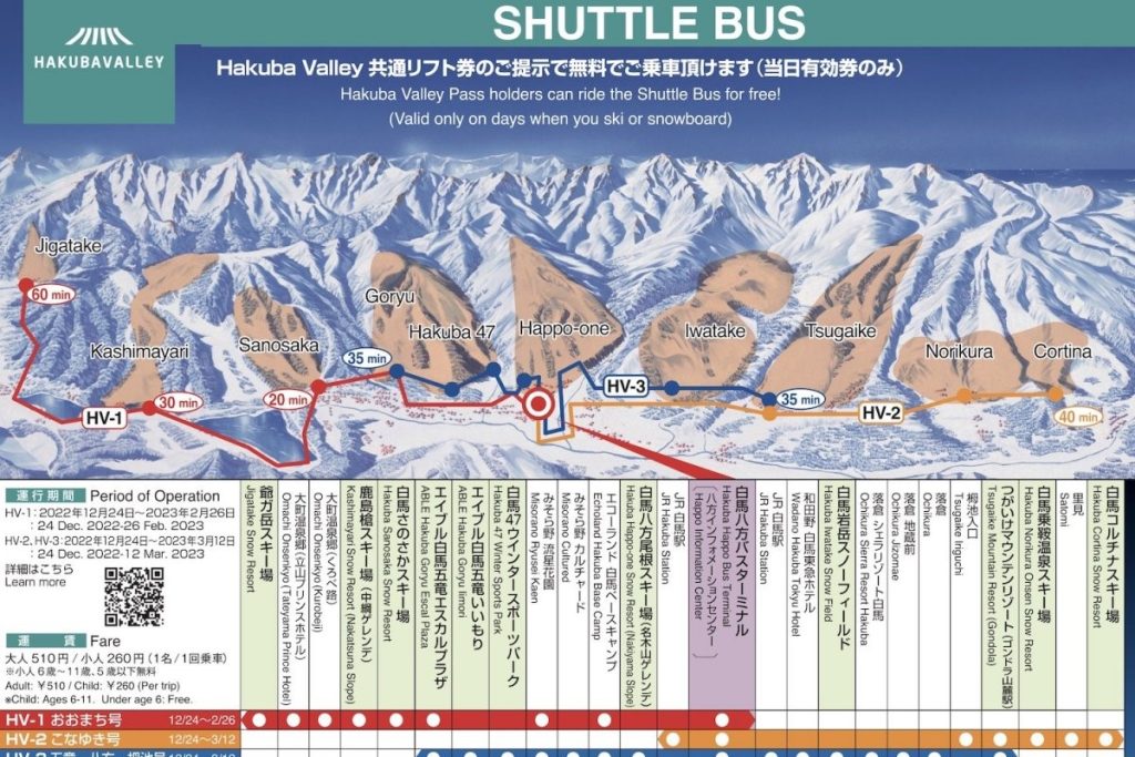
Hakuba Maps: Shuttle Bus Routes
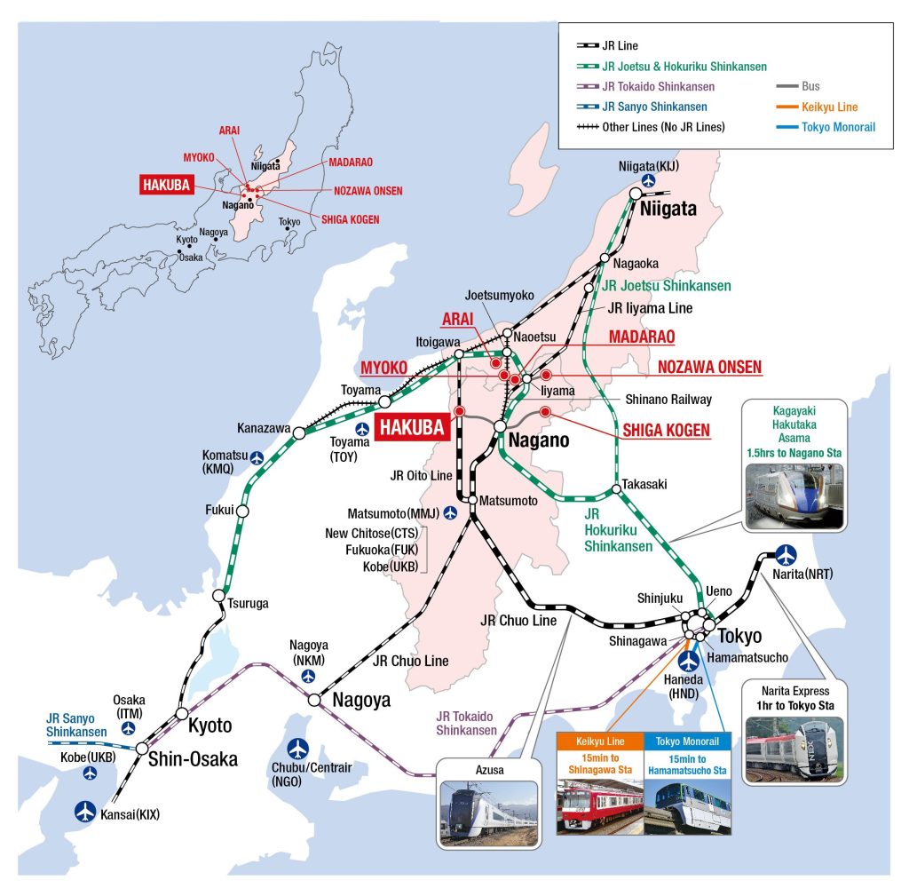
Find out more about how to get to Hakuba via our Hakuba Access Guide
See here for the latest Hakuba shuttle bus schedules and maps.
Hakuba Maps: Train/Bus/Resort
Train stations in regard to proximity to each Hakuba ski resort
